Top stories in Newfoundland and Labrador

UPDATED: Thanks for the memories, Bob: Newfoundland hockey broadcaster Bob Cole has died at age 90
Updated 4 hours ago
|11 min read

Supreme Court of Canada to hear travel ban appeal of Newfoundlander
Updated 37 minutes ago
|2 min read

Team Gushue Highway completion held up by several factors, including bureaucracy
Updated 13 minutes ago
|3 min read
From a little boy 'succeeding with everything he did' to an addict: N.L. mom desperate to get help for her son
Updated 21 hours ago
|13 min read
Man from N.L. glad to hear of Limitations Act amendments
Updated a day ago
|6 min read
Local
More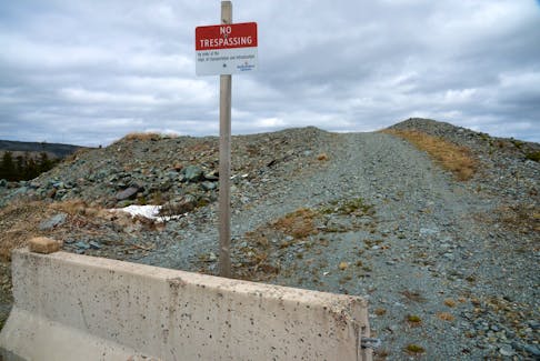
UPDATED: Thanks for the memories, Bob: Newfoundland hockey broadcaster Bob Cole has died at age 90
Updated 4 hours ago
|11 min read
Schrödinger's House (of Assembly) cat: N.L. shelter standards expected by June
Updated 53 minutes ago
|5 min read

Supreme Court of Canada to hear travel ban appeal of Newfoundlander
Updated 37 minutes ago
|2 min read
Mackerel bait fishery opening in Atlantic Canada ‘a slap in the face,’ says Newfoundland and Labrador harvesters’ union
Updated 10 hours ago
|4 min read
DFO opening mackerel bait fishery for Atlantic Canada and Quebec, but commercial fishery remains closed
Updated 19 hours ago
|3 min read
Opinion
More
GWYNNE DYER: Arctic seals and coral reefs facing extinction, but every little bit helps
Updated 18 hours ago
|4 min read

LETTER: Justice and science in public health policy needed as federal government hikes taxes for vaping
Updated 19 hours ago
|3 min read

LETTER: Carbon tax is simply another irrational decision by the current government to further burden all of us
Updated 19 hours ago
|8 min read
LETTER: 'Tear down the wall' and let family members inherit fishing enterprises in N.L. without jumping through financial hoops
Updated 20 hours ago
|3 min read
BOB WAKEHAM: Battles between N.L. premiers and Ottawa nothing new
Updated 21 hours ago
|7 min read
Business
More
All fuel prices drop in Newfoundland and Labrador overnight Thursday, April 25
Updated a day ago
|1 min read

Prices at the Pumps: Some small relief, more for diesel
Updated 15 hours ago
|1 min read

Construction boom hits Moncton in first quarter of 2024
Updated 19 hours ago
|2 min read
Union to launch boycott of Java Blend coffee shops in Halifax
Updated 19 hours ago
|3 min read
Futures climb as Alphabet, Microsoft results lift megacaps
Updated 5 minutes ago
|3 min read
Lifestyles
More
PAUL SMITH: What's the best bet for raincoats? Plenty of good options for outdoor enthusiasts in N.L.
Updated 23 hours ago
|9 min read


JOAN SULLIVAN: Crisp and evocative writing in Donna Morrissey’s seventh novel, 'Rage the Night'
Updated a day ago
|5 min read
Scary, exciting times: Some first-time buyers perservering despite frustrating market challenges
Updated a day ago
|5 min read
Curious, not furious: How to manage a child's big emotions
Updated a day ago
|5 min read
Sports
More
On the ice with the pros: Mount Pearl girl hits ice as an anthem skater for PWHL game in Ottawa
Updated a day ago
|4 min read

Brad Marchand's antics driving Leafs and their coach batty: 'It's an art and he's elite at it'
Updated 19 hours ago
|6 min read

Baseball NL wants more players and communities to 'Step Up to the Plate'
Updated 21 hours ago
|2 min read
Host Mount Pearl Blades win 2024 Don Johnson Memorial Cup opener
Updated a day ago
|4 min read
Atlantic All-Star event in Halifax will showcase the region's top female basketball players
Updated Apr. 23, 2024
|4 min read
Canada
More
Downtown Charlottetown market moving to Confederation Landing, not Founders’ Hall, pending approval
Updated 6 minutes ago
|6 min read

Halifax Muslims mourn smiling teen, ‘are scared for their children’
Updated 11 minutes ago
|3 min read

Gas prices go up in P.E.I. on April 26, 2024
Updated 23 minutes ago
|1 min read
Conservative Leader Poilievre keeps calm, carries on with 'Axe the Tax' tour at Cape Breton stops
Updated 12 hours ago
|7 min read
'It felt like a slap': Cape Breton disability advocate says proposed Canadian disability benefit not enough
Updated 12 hours ago
|6 min read
World
More
Factbox-Who are the mega-rich donors backing Trump?
By Alexandra Ulmer and Jason Lange (Reuters) - A handful of mega-rich donors have emerged as key backers of Republican presidential candidate Donald Trump, collectively donating more than $50 million to support his candidacy against Democratic ...
Updated 4 minutes ago
|4 min read
Former tabloid publisher to face more questions in Trump hush-money trial
Updated 4 minutes ago
|2 min read

Analysis-Trump election subversion case bogs down as allies' legal woes grow
Updated 4 minutes ago
|4 min read

Why BYD's EV exports sell for twice the China price
Updated 6 minutes ago
|6 min read
Burkina Faso suspends BBC, VOA radio broadcasts over killings coverage
Updated 13 minutes ago
|2 min read
Russia's Forbes magazine says one if its journalists has been detained for 'fake news' allegation
Updated 24 minutes ago
|1 min read
Recent Stories


Former tabloid publisher to face more questions in Trump hush-money trial
Updated 4 minutes ago
|2 min read
Analysis-Trump election subversion case bogs down as allies' legal woes grow
Updated 4 minutes ago
|4 min read
Remembering Joseph Henry Denny of Eskasoni, a leader in addiction services
Updated 5 minutes ago
|7 min read
Futures climb as Alphabet, Microsoft results lift megacaps
Updated 6 minutes ago
|3 min read