Top stories in Newfoundland and Labrador
'I'm alive': St. John's woman felt like she was ripped from another world when she woke up from 18-hour invasive brain surgery
Updated 14 hours ago
|12 min read

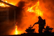
Paradise home destroyed by fire late Wednesday night but family escapes uninjured
Updated 19 hours ago
|6 min read
Housing project given provincial funding but denied by St. John's council because land cannot be currently developed
Updated 14 hours ago
|4 min read
N.L. Tories demand travel nurse cost breakdown
Updated 14 hours ago
|5 min read
Lawyer’s sexual assault trial in St. John's turns once again to allegations against police officer
Updated 14 hours ago
|5 min read
Local
More
St. John's Pitts Memorial Drive load limit reduced to 15 tonnes April 22-23
Updated 4 hours ago
|2 min read
RCMP arrest man for swinging weapon at driver in Glovertown
Updated 8 hours ago
|1 min read

N.L. awards two contracts for urgent care centres on Northeast Avalon
Updated 5 hours ago
|2 min read
Major's Path and Portugal Cove Road road work in St. John's starting soon
Updated 5 hours ago
|3 min read
St. John's man and woman sent to hospital following apparent targeted home invasion: RNC
Updated 7 hours ago
|2 min read
Opinion
More
LETTER: Leave personal life out of politics
Updated 7 hours ago
|3 min read

LETTER: Christians supporting Donald Trump and other Right-wing politicians concerning
Updated 8 hours ago
|2 min read

LETTER: Weak apology for traumatizing those who are already traumatized
Updated 8 hours ago
|2 min read
LETTER: Questioning the N.L. government's ethics after 'provincial government official' tip
Updated 9 hours ago
|2 min read
LETTER: Carbon pricing works
Updated 10 hours ago
|2 min read
Business
More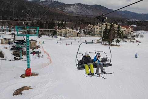
N.L. gas prices up 3.5 cents overnight Thursday, April 18
Updated a day ago
|1 min read

Prices at the Pumps: An up and down week at the pumps
Updated a day ago
|1 min read

MONEY LADY PODCAST: How to author a wealthier life
Updated 2 hours ago
|1 min read
Cultural care: New long-term care facility opens in Eskasoni
Updated 13 hours ago
|8 min read
SYLVAIN CHARLEBOIS: The Trudeau paradox of more spending and more hunger
Updated 2 minutes ago
|4 min read
Lifestyles
More
ERIN SULLEY: Have you seen the viral yogurt clusters? You’ll be drooling over these delicious chocolate strawberry treats
Updated a day ago
|6 min read

Filling an important role: Newfoundland and Labrador non-profit organizations discuss the value of volunteers
Updated a day ago
|8 min read

JOAN SULLIVAN: New Gwynne Dyer book an eye-opening look at climate change
Updated a day ago
|5 min read
BRUCE MACTAVISH: An Icelandic bird bonanza arrives in N.L. to the delight of birders
Updated Apr. 16, 2024
|5 min read
Sunny disposition: How to avoid and treat small dark spots on the skin called sunspots
Updated Apr. 16, 2024
|4 min read
Sports
More
Despite tough season, N.L. tourism minister says province sees value in investing in Marble Mountain, focusing on year-round operation
Updated 12 hours ago
|7 min read

Four N.L. teams start Atlantic hockey tournaments on Thursday
Updated 13 hours ago
|2 min read

N.L. Sports Notepad: Travis Crickard is heading back to Team Canada bench
Updated a day ago
|7 min read
‘BOTTCHER BOMBSHELL:’ Alberta curling foursome set to move forward without skip
Updated Apr. 16, 2024
|3 min read
NHL-League approves Coyotes sale and new franchise in Utah
Updated 1 hour ago
|3 min read
Canada
More
N.S. justice minister apologizes for saying domestic violence isn’t epidemic
Updated 3 hours ago
|3 min read
Bright Side
Hottest ticket in town: Cape Breton Eagles playoff fever continues
Updated 2 hours ago
|1 min read

Charlotte Street businesses brace for final round of downtown Sydney redevelopment
Updated 2 hours ago
|11 min read
Canada's capital gains tax rise will further knock productivity, say economists
Updated 5 hours ago
|2 min read
Gamon Leacock elects jury trial on charges from Halifax attacks on women
Updated 5 hours ago
|2 min read
World
More
Teenager charged with terrorism over Sydney bishop stabbing
Updated 26 minutes ago
|2 min read
Biden taps Curtis Ried to be next US ambassador to OSCE, White House says
Updated 26 minutes ago
|1 min read

UK PM Sunak to consult on tougher rules to combat 'sick note culture'
Updated 36 minutes ago
|2 min read
Latin America must brace as El Nino flips to La Nina, experts warn
Updated 1 hour ago
|2 min read
North Korea, Belarus deputy foreign ministers agree to strengthen ties
Updated 1 hour ago
|1 min read
Recent Stories

Teenager charged with terrorism over Sydney bishop stabbing
Updated 26 minutes ago
|2 min read
Biden taps Curtis Ried to be next US ambassador to OSCE, White House says
Updated 26 minutes ago
|1 min read
UK PM Sunak to consult on tougher rules to combat 'sick note culture'
Updated 36 minutes ago
|2 min read