Top stories in Newfoundland and Labrador

Canada's budget 2024: More spending, higher capital gains taxes, bigger deficits
Updated 10 hours ago
|4 min read


Goulds man arrested after alleged knifepoint carjacking in Deer Park
Updated 13 hours ago
|2 min read
Corner Brook man, 26, tickted for speeding in Deer Lake construction zone
Updated 10 hours ago
|1 min read
Local
MoreBudget 2024 met with criticism by N.L. labour leaders
Updated 6 hours ago
|5 min read

Accused's medical records reviewed at St. John's sexual assault trial
Updated 6 hours ago
|3 min read

Same job, different pay: N.L. nurses criticize pay inequities, but this time it has nothing to do with private agency nurses
Updated 7 hours ago
|7 min read
ArtsNL using $3 million to support local artists through existing programs
Updated 15 hours ago
|2 min read
Corner Brook man, 26, tickted for speeding in Deer Lake construction zone
Updated 10 hours ago
|1 min read
Opinion
More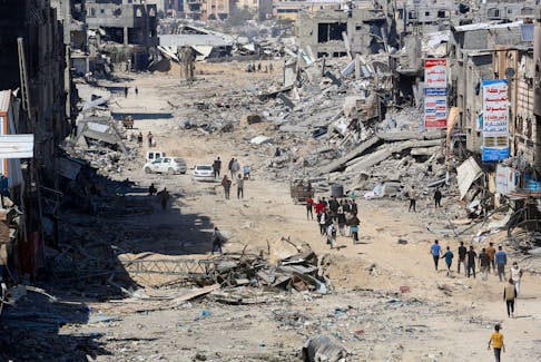
LETTER: Retaliation or revenge?
In February 1944, the Bishop of Chichester, George Bell, spoke in the House of Lords against the policy of the blanket bombing of towns and cities in Germany in the Second World War. What was called 'terror bombing" was a major weapon for both sides ...
Updated 16 hours ago
|7 min read
LETTER: The climate crisis requires all hands-on deck
Updated 16 hours ago
|2 min read

Cheers and Jeers for Newfoundland and Labrador April 9
Updated Apr. 9, 2024
|8 min read

GWYNNE DYER: Iran and Israel, a pantomime crisis, not a real war
Updated a day ago
|7 min read
BRIAN HODDER: We need to make a difference in the environment every day, not just Earth Day
Updated a day ago
|3 min read
LETTER: Willing to accept wind farms if it will save our planet
Updated Apr. 11, 2024
|2 min read
Business
More
Cove Drinks of Halifax has begun shipping its no-sugar sodas to 575 Costco stores in the U.S., forecasts revenue of $100 million
Updated 11 hours ago
|5 min read

Over 50 employers and service providers taking part in job fair in New Glasgow, N.S.
Updated 17 hours ago
|3 min read

Mallard Cottage in St. John's may be forced into bankruptcy
Updated 22 hours ago
|5 min read
Inflation likely rose in March, but not enough to change Bank of Canada's direction
Updated a day ago
|3 min read
HSBC to cut another 20 investment banking jobs in Asia, sources say
Updated 10 minutes ago
|1 min read
Lifestyles
More
Sunny disposition: How to avoid and treat small dark spots on the skin called sunspots
Updated 16 hours ago
|4 min read

Carbonear's Got Talent: 20 Questions with Matthew Cooper
Updated a day ago
|7 min read

'It’s a marathon that should never stop': Terry Fox’s story still resonates 44 years later
Updated a day ago
|7 min read
Exhausting experience: ‘It’s the anxiety of not knowing what will be a trigger that day,’ says Islander with epilepsy
Updated a day ago
|6 min read
Tackling the invisible: Atlantic Canadians navigate gender roles and invisible labour
Updated a day ago
|7 min read
Sports
More
‘BOTTCHER BOMBSHELL:’ Alberta curling foursome set to move forward without skip
Updated 11 hours ago
|3 min read

MLB roundup: Amed Rosario rallies Rays over Angels in 13
Updated 20 minutes ago
|7 min read

Tennis-Gauff keen to end claycourt trophy drought ahead of French Open
Updated 1 hour ago
|2 min read
NHL roundup: Capitals clip Flyers to land playoff berth
Updated 1 hour ago
|4 min read
Tennis-Nadal stays in control to make winning return in Barcelona
Updated 2 hours ago
|2 min read
Canada
More
Olympics-Team Canada goes for cool factor in Paris Games kit
Updated 9 hours ago
|2 min read

Cape Breton's Steel Grounds Café opens new location on Sydney waterfront
Updated 9 hours ago
|4 min read

'It took a whole lifetime to find that guitar for me': Cape Breton musician recovers stolen guitar
Updated 9 hours ago
|2 min read
'We’re in a very different place than we were last year': Wildfire risk low in Cape Breton due to snow, rain
Updated 10 hours ago
|5 min read
PHOTO: Final phase of Charlotte Street reconstruction underway in Sydney
Updated 10 hours ago
|1 min read
World
More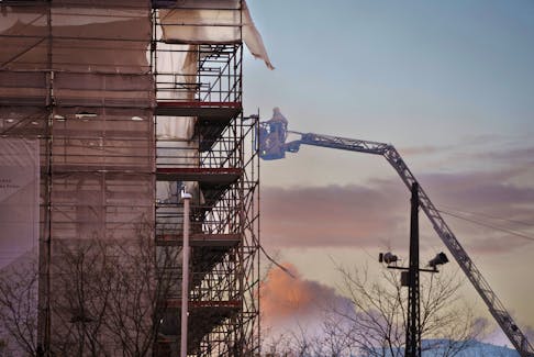
Russian attack kills people in Ukraine's Chernihiv, hits infrastructure, governor says
Updated 29 minutes ago
|1 min read

GSK says efficacy of its shingles vaccine remains high after years
Updated 1 hour ago
|1 min read

Italy foreign minister calls on Israel to halt military operations in Gaza
Updated 1 hour ago
|1 min read
Ships docked, trains halted as Greek workers strike over rising costs
Updated 1 hour ago
|1 min read
Japan opposition party to propose using BOJ's ETF dividends for child care
Updated 2 hours ago
|2 min read
Recent Stories

Part of Denmark's historic stock exchange reduced to empty shell after blaze
Updated 9 minutes ago
|1 min read

HSBC to cut another 20 investment banking jobs in Asia, sources say
Updated 10 minutes ago
|1 min read
MLB roundup: Amed Rosario rallies Rays over Angels in 13
Updated 20 minutes ago
|7 min read
LVMH shares rise after luxury giant's Q1 sales offer element of reassurance
Updated 30 minutes ago
|1 min read
Toyota recalls Prius cars, halts orders due to door handle fault
Updated just now
|1 min read