Top stories in Newfoundland and Labrador

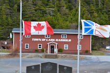
‘I’ve never seen such a caring, generous group of people’: Outpouring of support for families of two Lark Harbour men who died while lobster fishing
Updated 22 hours ago
|6 min read
After many petitions, N.L. government says it will amend Limitations Act
Updated 23 hours ago
|3 min read

N.L. government ministers call tent city a ‘campsite,’ ‘protest’
Updated a day ago
|2 min read
PCs hammer Liberals for total cost of 2021 cyberattack
Updated a day ago
|5 min read
Taxi industry concerned about 'unlevel playing field' as Uber officially launches in province
Updated 23 hours ago
|7 min read
Local
More
'Flying planes by french fries': Come by Chance refinery fully operational; 50 years in the community
Updated 8 hours ago
|5 min read

Mallard Cottage and BDC make first court appearance
Updated 12 hours ago
|3 min read

Bonavista police investigating break-in, theft at Anglican Christ Church
Updated 12 hours ago
|1 min read
N.L. teams with national non-profit to establish $1.5M affordable housing fund
Updated 15 hours ago
|2 min read
Pair arrested, cocaine seized in Corner Brook drug bust: RCMP
Updated 17 hours ago
|2 min read
Opinion
More
MARTHA MUZYCHKA: Rough sex is climbing among young people, and we need to talk about it
Updated 18 hours ago
|5 min read

COMMENTARY: Social media companies and parents must help tech-addicted children
Updated 18 hours ago
|8 min read

LETTER: Getting more back in carbon rebate than we're spending
Updated 18 hours ago
|2 min read
LETTER: New Canadian Dental Care Plan ensures most low and moderate-income people have access to affordable dental services
Updated 18 hours ago
|4 min read
Cheers and Jeers for Newfoundland and Labrador April 23
Updated a day ago
|6 min read
Business
More
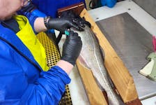
Time to double the quota? Owner of only N.L. fish plant to process exclusively northern cod thinks stocks are ready and is working to regain its position in global marketplace
Updated 19 hours ago
|7 min read
Roll Up to Win confusion: Cape Bretoners disappointed after Tim Hortons email mistake
Updated 11 hours ago
|6 min read

CBRM seeks land-use bylaw change for supportive housing units
Updated 23 hours ago
|5 min read
Five Corners Properties talk 3,000 unit housing project in Bible Hill
Updated a day ago
|5 min read
European stocks slip as mixed earnings offset M&A cheer
Updated 30 minutes ago
|1 min read
Lifestyles
More
JOAN SULLIVAN: Crisp and evocative writing in Donna Morrissey’s seventh novel, 'Rage the Night'
Updated 19 hours ago
|5 min read

Scary, exciting times: Some first-time buyers perservering despite frustrating market challenges
Updated 15 hours ago
|5 min read

Curious, not furious: How to manage a child's big emotions
Updated 16 hours ago
|5 min read
If the earth moves, does everybody feel it? Newfoundland and Labrador regularly has earthquakes but no one notices
Updated a day ago
|7 min read
'I was always the biggest film buff': 20 questions with award-winning N.L. filmmaker Christian Sparkes
Updated Apr. 22, 2024
|11 min read
Sports
More
Atlantic All-Star event in Halifax will showcase the region's top female basketball players
Updated a day ago
|4 min read

TELUS CUP: Magog Cantonniers remain undefeated with win over host Sydney Mitsubishi Rush on Wednesday
Updated 1 hour ago
|5 min read

NHL roundup: Knights make it two straight at Dallas
Updated 2 hours ago
|2 min read
MLB roundup: Braves get walk-off win in 10th, sweep Marlins
Updated 3 hours ago
|8 min read
Tennis-Osaka doing her homework on clay ahead of French Open
Updated 4 hours ago
|2 min read
Canada
More
Roll Up to Win confusion: Cape Bretoners disappointed after Tim Hortons email mistake
Updated 11 hours ago
|6 min read
AMANDA MCDOUGALL-MERRILL: Homelessness in CBRM reason for concern
Updated 12 hours ago
|5 min read

Former CBRM mayor to announce political plans in mid-May
Updated 12 hours ago
|2 min read
P.E.I. Health Coalition raises concerns over privatization threats to public health care
Updated 12 hours ago
|6 min read
Poached elvers still getting exported despite DFO busts and closed season
Updated 13 hours ago
|5 min read
World
More
Shawarma restaurant in Cairo brings taste of home for displaced Palestinians
Updated 19 minutes ago
|3 min read

Factbox-Italian tourist hotspots start to raise defences against overcrowding
Updated 19 minutes ago
|2 min read

Scotland's SNP-Green government coalition collapses - Sky News
Updated 9 minutes ago
|1 min read
India's poll panel seeks responses to complaints against Modi, Rahul Gandhi
Updated 29 minutes ago
|1 min read
Russian missile damages civilian, railway infrastructure in Ukraine's Cherkasy region, air force says
Updated 59 minutes ago
|1 min read
Recent Stories


Factbox-Italian tourist hotspots start to raise defences against overcrowding
Updated 19 minutes ago
|2 min read
India's poll panel seeks responses to complaints against Modi, Rahul Gandhi
Updated 29 minutes ago
|1 min read
European stocks slip as mixed earnings offset M&A cheer
Updated 30 minutes ago
|1 min read
Analysis-BHP's proposed bid for Anglo American is a big bet on copper
Updated 30 minutes ago
|4 min read