Environment Canada has fined tuned its weather alerts for Newfoundland in advance of an approaching low pressure system that will bring some intense winter weather back to the island.
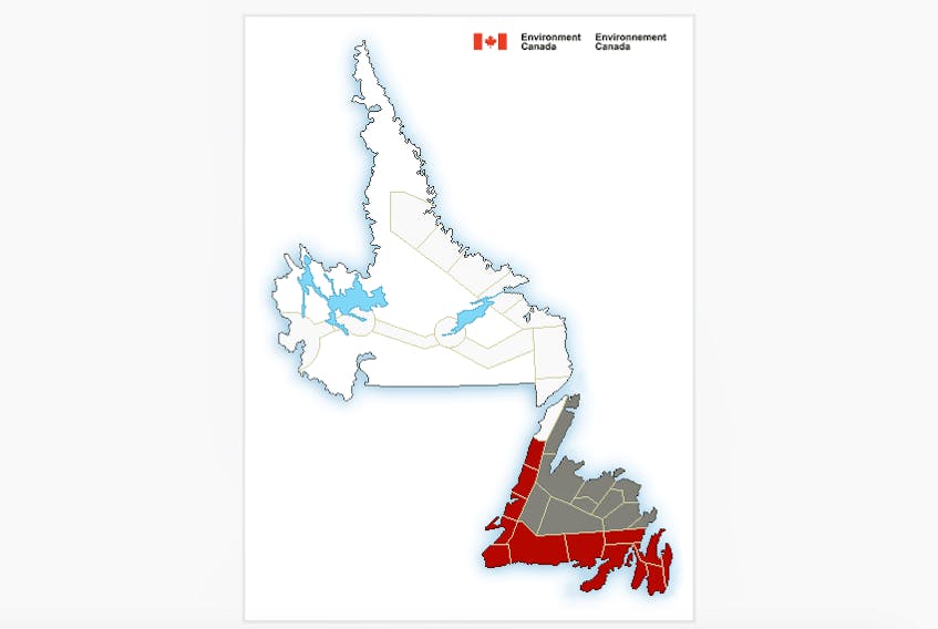
Winter storm warnings are in effect for the Avalon Peninsula southeast and southwest, the Burin Peninsula, and Connaigre.
Snowfall warnings have been put in place for Avalon north, Clarenville and vicinity, and St. John’s and vicinity.
Bay St. George, Burgeo-Ramea, Gros Morne, Parson’s Pond-Hawke’s Bay, Corner Brook and vicinity, and Channel-Port aux Basques and vicinity all have wind warnings. Channel-Port aux Basques and Burgeo-Ramea also have special weather statements and there is a Wreckhouse wind warning.
Meanwhile, special weather statements are in effect for most of the rest of the island including Bay of Exploits, Bonavista north, Bonavista Peninsula, Buchans and the interior, Deer Lake-Humber Valley, Gander and vicinity, Grand Falls-Windsor and vicinity, Green Bay-White Bay, Northern Peninsula east and Terra Nova.
Southeasterly winds will slam the Wreckhouse area with gusts up to 120 kilometres an hour, strengthening to 160 km/h this evening before dropping back to 110 km/h late overnight.
Snow ahead of the system will begin along the southwest coast of Newfoundland this evening, then taper to flurries on Saturday. Total snow accumulations approaching 15 centimetres in some areas by Saturday evening are forecast for the Port aux Basques and Burgeo regions.
Some parts of the Burin Peninsula could see up to 20 cm of snow in total before it tapers to scattered showers or flurries on Saturday morning. Strong easterly winds gusting to 100 km/h over exposed coastal areas will develop this evening and diminish again overnight. Relatively mild temperatures accompanying the storm are expected to limit blowing snow to localized exposed areas overnight.
Snow is forecast to begin near midnight Friday from Clarenville to St. John's and vicinity, becoming heavy at times overnight before tapering to scattered showers or drizzle on Saturday morning. Total snowfall accumulations will likely vary with amounts near 15 cm expected in areas where easterly winds accompanying the snow blow onshore.
The winds, gusting to 70 kilometres an hour, are likely to cause blowing snow overnight, before temperatures rise above freezing early on Saturday morning.
The snow is expected to spread to the Northern Peninsula by Saturday morning.
Periods of snow are forecast to persist through the weekend and into Monday in central and northern areas of the island.
For more information, visit Environment Canada’s public weather alerts at https://weather.gc.ca/warnings/index_e.html?prov=nl.