
The coastal boardwalk is raised up, higher than ground level. It’s built atop a stone and timber breakwater, meant to keep occasionally surging seas away from homes, businesses and schools, not to mention the roads, municipal buildings and the hospital.
At the other side of town, the Orcan River runs with high tides being kept back by a now-rusted, metal breakwater. The river used to regularly overflow, sending water throughout the downtown, in extreme nuisance flooding.
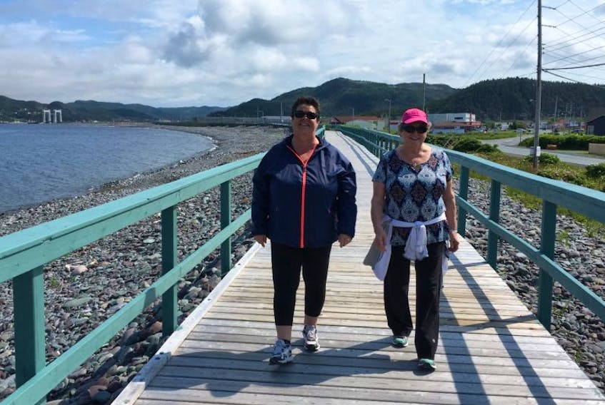
“We’re not talking about rubber boots, we’re not talking about hip rubbers. We’re talking about boats to get around,” said resident Donna Lambe, who was walking with friend Gail Ryan along the boardwalk Wednesday and stopped to speak with The Telegram.
Lambe recalled there was a Christmas season in the 1970s when people rowed house to house with turkey.
She said she started waiting out the worst floods on her husband’s fishing boat.
“A lot of people — say, where we live — it’s just a crawl space, because if you dig down too deep you’re into beach rock. So you’ll see hardly any of the houses have got basements,” Ryan said. “People used to put things under the crawl space and (during floods) there was buckets of beef and everything going down the road.”
The metal breakwater was built in 1993. Since then, instances of flooding have been dramatically reduced, with nothing of the kind of floods seen in the 1970s and 1980s. At the same time, the sea level has continued to rise.
The last public flood-risk mapping for Placentia was completed in 1985.
Life at high tide
“I find the biggest thing with Placentia is it’s like Placentia is sinking,” Lambe said.
“I find that even at a high tide, a normal high tide, you’ll see the water seeping in over the roads here. So I’m thinking climate change, in regards to climate change and Placentia, if the climate change is heading in a bad direction, I can see Placentia having problems.”
The climate change story involves sea level rise. At the local level, that includes considering changes happening specific to the place, in addition to global trends.

Martin Batterson is a senior geologist with the provincial Department of Natural Resources and director of the Geological Survey of Newfoundland and Labrador. In 2010, he completed a report with geologist David Liverman, who was also with the geological survey, providing estimates on the projected, relative sea level rise in Newfoundland and Labrador.
“Past and Future Sea-Level Change in Newfoundland and Labrador: Guidelines for Policy and Planning” was completed in a period after Batterson and Liverman had been detailing coastal disasters, including the 1929 tsunami, provincial landslides and flooding.
Batterson told The Telegram the pair had questions around that time from planners about climate change: what it really was and what the province’s general expectations were.
The 2010 report was meant to inform individual planning and public policy.
The geologists took the global estimate for relative sea level rise from the Intergovernmental Panel on Climate Change and paired it with known, ongoing movements of Newfoundland and of Labrador — the isostatic response — wherein the land here is still responding to the period when a large part of North America was covered and compressed by the massive Laurentide ice sheet (Newfoundland had its own ice cap).
In a nutshell, when the Laurentide glacial cover squeezed the continent, material was forced to the outer edges. As the ice sheet melted, there was a rebound in the land and also a return of material once displaced. The land’s readjustment continues, with parts of this province being moved up and down, independently affecting the high water mark.
Add to that the relative sea level rise expected from global climate change and you get the local longer-term predictions.
<Related: St. John’s started on anti-flooding measures>
In Batterson’s report, the estimates were rough and rounded up to the nearest 10 centimetres. However, it showed eastern Newfoundland — including the area of Placentia — is expected to see as much as a 40-centimetre increase in relative sea level by 2050 and more than a one-metre rise by the end of the century.
“It’s the general outlook,” he said, speaking with The Telegram this week. “We shouldn’t get hung up on the numbers … we know the sea level is going to rise significantly by the end of the century compared to the beginning of the century. And if that’s the case, we need to do something about it.”
Specifically, he hoped the report would be considered by planners, policy makers and even individuals. The geological survey, meanwhile, has pursued further study of provincial coastlines.

“I think part of it is the changes we’re talking about are quite slow. This is the problem with these things,” he said. “But they’re slow and cumulative, and they’re not going away.”
Not just Placentia proper
“I’ve seen water on the actual road here and that’s been in more recent years,” said Debbie Brown, standing on the front lawn of the colourful O’Reilly House Museum, built in 1902.
She was looking across Orcan Drive at Placentia’s metal breakwater — an orange-brown barrier between her and the river.
“There’s times now even when we have really high tides the water will come out onto the street,” she said.
Yet Brown said potential for flooding is also deserving of attention in neighbouring areas of Jerseyside, Freshwater, Ferndale and Dunville, all part of the municipality. “It’s not just (downtown) Placentia,” she said.
A 2011 report from AMEC, looking specifically at Laval High School in Placentia proper, but also briefly at area flood risk. It noted the entire area has infrastructure located in low-lying areas, vulnerable to flooding.
The report noted the areas outside of downtown Placentia have been hard hit in storms, even when central Placentia was not. It offered the example of post-tropical storm Chantal in 2007.
“In 2007,” it stated, “Dunville experienced flooding related to Chantal, but downtown Placentia escaped flooding.”
Today, you can let the water lap at your toes in Dunville just steps away from the fence of the William Hogan ballfield, in an area where sea level rise is happening faster than in other parts of the province.
Climate change risk awareness
Sea level rise is difficult to separate from topics like changes expected in precipitation and potential for future flooding.
Research by professor Joel Finnis with Memorial University’s department of geography, for example, has shown that by 2050 nearby Argentia will have a 100-year rain event at an expected maximum of 247.6 millimetres, as opposed to the historic maximum of 210 millimetres of rain — an increase of 18 per cent over the historic value.
“The existing 1 in 100-year flood zone for Placentia may well be effectively, by 2050, the 1 in 20-year flood zone, with areas formerly outside the 100-year zone now prone to flooding,” AMEC reported, citing Finnis’ work.
Flood zones matter because there are requirements already in place for government approvals when building within areas at high risk of flooding, as noted in Placentia’s Municipal Plan: 2014 through 2024.
It’s one of the reasons Mayor Wayne Power is interested in seeing flood-risk mapping updated, expressing as much to the provincial government, he said.
“We’ve had the potential for and been on watch for potential flooding in recent years and have luckily escaped that, but it does bring into question: are we prepared for what climate change is bringing us?” Power said.
Preparation and prevention of damage, he suggested, requires the best information available.
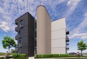
Power was asked about a new, regional wellness centre planned for Placentia, just a stone’s throw away from the water. He said sea level rise has already been factored into the plans.
“We have looked at the flood risk in that area and engineered the design to reflect that,” he said.
‘What’s climate change?’
Back on the Placentia boardwalk, under a summer sun and beside calm seas, Lambe and Ryan both said people are aware of flood risk generally, but not really climate change and certainly not climate change as it relates to their area.
Lambe included herself in that assessment.
“I know of climate change and I know there’s things happening that normally shouldn’t happen, when it comes to erosion and glaciers and this kind of stuff — all affected by climate change,” she said. “But a lot of people: ‘What’s climate change? Sun today, rain tomorrow.’”
Ryan said she sees Placentia adapting to whatever comes its way.
The provincial government has paid for a risk assessment specific to the new Laval High School. There have been repairs to the oceanfront breakwater and an extension of armour stone to cover more of the breakwater than was covered in the 1960s.
“We know that one of the effects of global warming is a rise in sea level, and we understand the risks involved for a town like Placentia,” area MHA Sherry Gambin-Walsh stated in an email Friday.
She said she recalled seeing rowboats out during a flood in the area in the 1970s, when she was a child, and credited the town for including sea level rise in its official planning.
“Informed planning for development of any type in areas potentially affected by sea level is critical,” she said.
The province is working on updating flood-risk maps as part of the work of the Office of Climate Change. The Telegram is scheduled to speak with Minister Perry Trimper about work within the climate change office in the coming weeks.
(NOTE: This story has been edited to clarify the suggestion of Debbie Brown, who said flooding is worth considering for higher areas, but not specific to sea level rise. She specifically sees sea level rise as a conversation specific to the lower-lying areas, for example in Dunville and Placentia.)