Environment Canada issued the warning around 5:15 this morning, saying significant snow, strong northeasterly winds and blowing snow are expected tonight and Monday morning.
"Light snow is forecast to begin this evening and become heavy at times overnight, then continue into Monday morning," the warning for the St. John's area reads. "The snow is expected to change to ice pellets or freezing rain by Monday afternoon. Snow will return to the region Monday night, then taper to flurries on Tuesday."
Snowfall accumulations of 15 to 30 cm are forecast for the metro area by Monday morning, with more expected Monday night and Tuesday.
Predicted snowfall amounts for other areas of the province vary between 15 and 35 centimetres.
Strong winds and the new snow will combine to create blizzard conditions with near-zero visibility, Environment Canada says. Wind gusts are expected to reach 80 kilometres an hour over most areas and up to 110 kilometres an hour along parts of the coast on Monday afternoon.
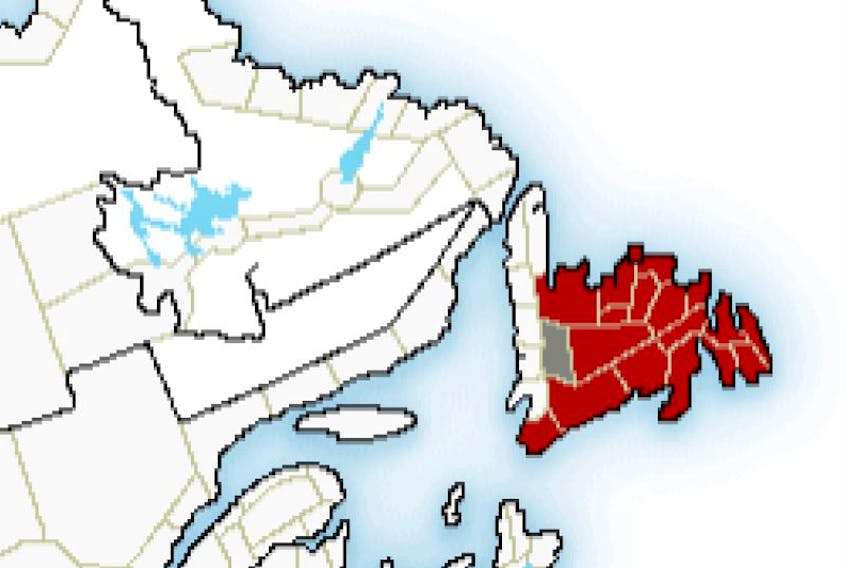
Deer Lake-Humber Valley and Burgeo-Ramea are the only parts of the island not currently under a blizzard warning, though a blowing snow advisory is in effect for both areas.
The Telegram will continue to provide updates on the weather.
Weather statement upgraded to blizzard warning for most of Newfoundland
Remember that special weather statement issued Saturday morning for the entire province? It's been upgraded to a full-on blizzard warning.
STORY CONTINUES BELOW THESE SALTWIRE VIDEOS
Two youths charged with second degree murder | SaltWire #newsupdate #halifax #police #newstoday