During the summer, most of us don’t care much about sea surface temperatures… until we decide to head to the beach.
If you’ve been to one of our magnificent coastal beaches you’ve certainly noticed the water is warmer than normal. That is an understatement.
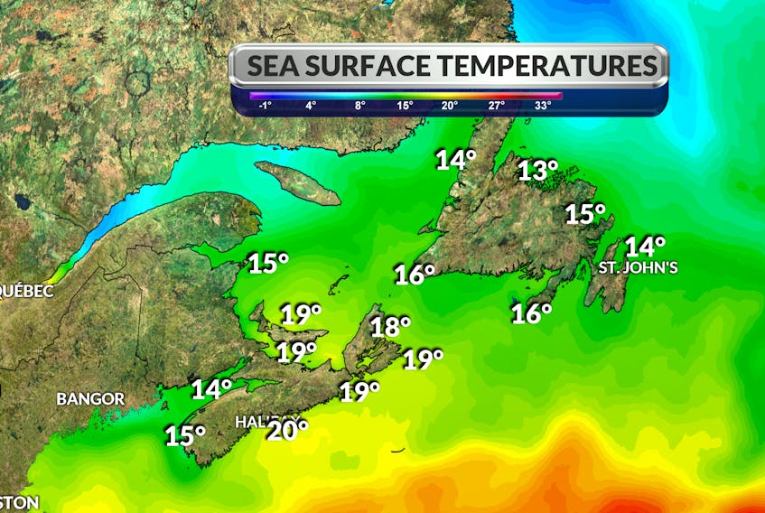
For several weeks, sea surface temperatures in the western North Atlantic Ocean have been, well, unusually warm. Off our coastlines normally chilly waters have been running as much as 5°C warmer than average. That’s significant!
Experts are referring to the situation in the Gulf of Maine as a “marine heat wave.” During the first week of August, NOAA satellites measured an average sea surface temperature of 20.52°C, which fell just shy of a record set in 2012.
The Gulf of Maine is one of the fastest-warming bodies of water in the world. Using satellite data, scientists have found that over the past 30 years, the Gulf has warmed more than three times faster than the global average and in the past 15 years, the region has warmed seven times faster than the global average rate.
Why is this significant? Warm sea surface temperatures warm the air above it and help transport more heat energy and moisture into the atmosphere. The persistently warm waters off our coasts this summer have contributed to record-warm overnight temperatures and high humidity levels.
Here’s a look at some regional sea surface temperatures or SST:
Water temperature measurements are provided by NOAA’s daily satellite readings. The temperatures given are the sea surface temperature (SST), which is most relevant to recreational users.
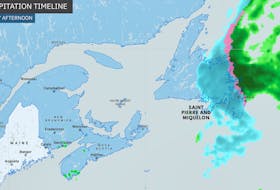
Come fall, these numbers take on a little more significance. They are one of the factors in fuelling and sustaining tropical storms as they make their way up the coast into Canadian waters.
- Want more weather information? Visit WeatherByDay.ca
- Have a weather question, photo or drawing to share with Cindy Day? Email [email protected]
Cindy Day is the chief meteorologist for SaltWire Network.