March seems to be going out like a lion, complete with the roar …. of winds.
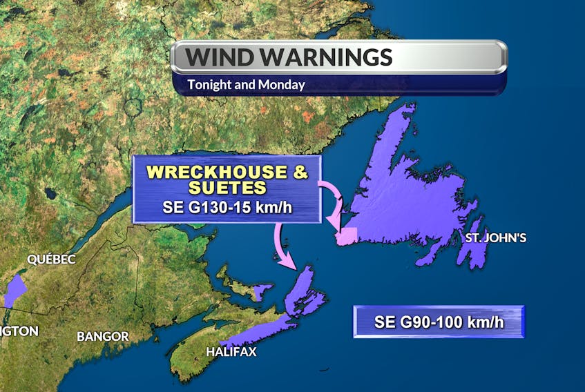
Wind warnings are in effect for all of Newfoundland Monday, with gusts of 100 kilometres per hour or more, accompanied by precipitation.
It’s all part of a spring storm that began by moving quickly across the Maritimes Sunday and that’s set to sweep into Newfoundland today.
On the west coast of the province, winds will be coming from the northwest, and since 5 to 10 centimetres of snow is also expected in much of the region, there will is the expectation of some blowing snow and reduced visibility.

As the system hits the rest of the island, the precipitation will be different. In St. John’s, for example, the forecast is for mixed precipitation changing to rain in the afternoon.
What’s the same is the high winds, again gusting to 100 km/h and in some coastal areas, up to 120 km/h, with wind direction changing from southeast to southwest overnight.
Forecast precipitation amounts in the metro area are a combined 2 cm of ice pellets and snow, then 2-4 millimetres of rain.
The rain amounts will be much higher on the Burin Peninsula and south coast, where daytime precipitation will be in the 20 to 40 cm range, again with the complicating factor of high winds.
Conditions should calm down Tuesday, when only flurries are forecast. Temperatures are expected to rise significantly later in the week; by Friday, they could be hitting high single digits in St. John’s and even higher in Corner Brook.