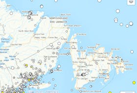
It’s looking like a windy and snowy day for the province today, according to a series of special weather statements and wind warnings issued by Environment Canada
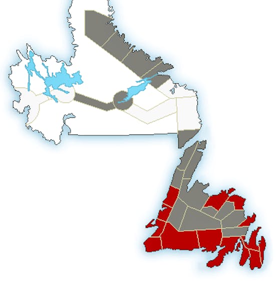
The entire island of Newfoundland is subject to either wind warnings or special weather statements beginning midday today through to Tuesday morning.
Significant wind is expected for southern, eastern and northeastern parts of the island, with gusts around 80 km/h except 110 km/h along parts of the coast.
The forecast winds are such that Environment Canada says anyone with Halloween decorations outside should consider bringing them inside as they are at risk of being tossed — or lost — by the wind.
Damage to buildings, especially to roof shingles and windows, may also occur.
The Wreckhouse area is expected to get wind gusts around 130 km/h this afternoon. Environment Canada is also reminding motorists to be prepared to adjust driving for the changing road conditions due to high winds.
You can also toss in some precipitation, with rain also in the forecast for most areas, with the added possibility of evening thundershowers in some regions.
The Labrador Straits are expected to get near 50 mm of rain between this morning and noon Tuesday, with higher amounts possible.
The southwest parts of the island are expecting 20 to 40 mm.
Precipitation is also coming to parts of Labrador, but in a different form. Significant snowfall is on the way for the areas of Nain, Hopedale, Churchill Valley, Upper Lake Melville, Postville, Makkovik and Rigolet.
From this morning through Tuesday afternoon, between 20 to 40 cm is expected to fall, with higher amounts possible.
Strong northerlies will develop this evening causing reduced visibility with blowing snow over exposed areas.
Conditions are expected to improve by Tuesday afternoon.
Cold-weather record in Badger
Meanwhile, it was a record cold Halloween for the Badger area.
Environment Canada said the area set a daily minimum temperature record on Saturday at -10 C. The previous record was -8.9 C, set in 2001.
Records have been kept for the area since 1956.