By late Friday morning, SaltWire Network meteorologist Cindy Day was still waiting for things to get worse.
“At 11 o’clock this morning, (the eye of the storm) sits about 350 kilometres southwest of the tip of the Avalon,” she said in an interview from Nova Scotia. “While it really is nasty right now, it’s not nearly as bad as it’s going to be.”
6 hour picture collage of the driveway. My civic is slowly disappearing under the drift that keeps on growing. #nlwx @EddieSheerr #nlblizzard2020 #nlstorm #snowday pic.twitter.com/6TeAqG7LLA
— Ms Kerri Mercer JRI (@ScienceMercer) January 17, 2020
At that time, winds were gusting at 90 kilometres an hour but were expected to reach 140 km/h along the coastlines.
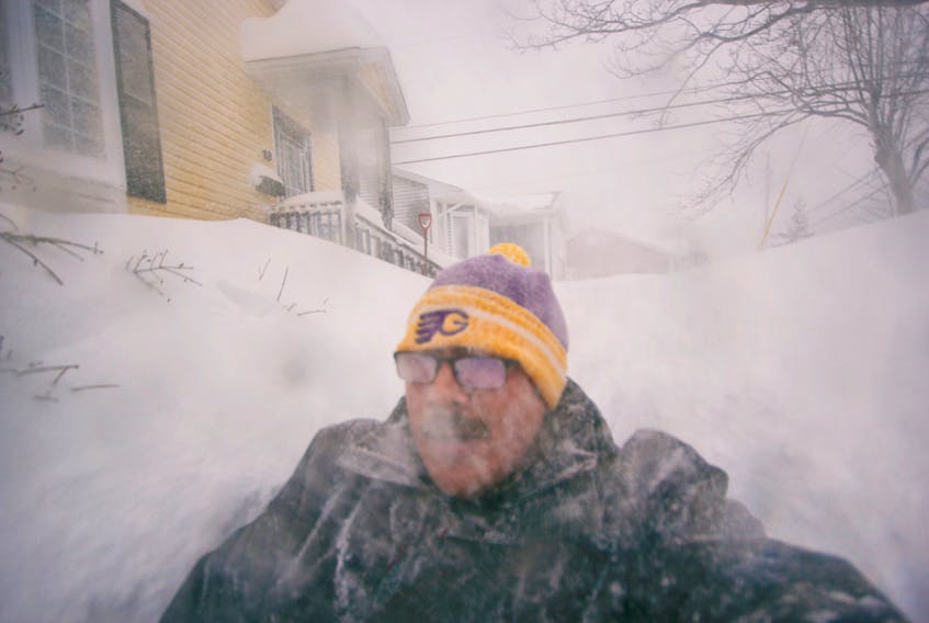
“The winds are the No. 1 problem with this storm,” Day says. “That wind is going to create whiteout conditions that will continue all day and through the morning tomorrow, so near zero visibility.”

Snowfall totals dropped off quickly outside the Avalon Peninsula. The Gander area was expecting 10 to 15 centimetres Friday, and 10 to 15 centimetres Friday night. However, the wind were expected to gust to up to 100 km/h, causing poor visibility.
As you make your way west, the snowfall totals drop off even more, at about five to 10 centimetres.
“The system is staying off the tip of the Avalon, (so) the energy is close to that system, and snowfall totals really drop off (as you get farther away),” Day said.
“But it’s a windstorm for the entire island.”
Because of the northeast direction of the wind, the Wreckhouse area of the west coast was not expected to be windier than anywhere else.
Seventy centimetres of snow was expected in the St. John’s vicinity and parts of the Bonavista Peninsula. Because of the wind, it may be piled up to 150 centimetres deep in some areas, while clearing other areas out.
My Mom's house in #newfoundland.
— hυ𝓶𝔸ᑎiℕค𝐓ยяє 🐺 💓 🌍 🙌 (@ChrisRa1ph) January 17, 2020
Pics 30-60 minutes apart.
Last one is 2:30PM NST!!!
The White Walkers would turn around if they come upon The Rock!#WeTheNorth
Stay safe. Stay warm. #nlweather#nlwx #nlblizzard2020 @weathernetwork pic.twitter.com/Vhk8uBFHqr
“It’s going to be difficult to gauge whether it’s snowing or just blowing around,” Day said.
That wind will also create an incredible amount of wave action along northeast facing coastlines causing storm surges. A storm surge is the amount of water the ocean lifts out its bed.
Storm surge warnings were in place Friday, with expected surges of 50 to 80 centimetres. But combined with the wind, the waves are expected to reach between nine and 12 metres as they break up before they hit the coastline, Day said. These powerful waves will cause coastal erosion.
“It’s so important to keep in mind how powerful this storm really is and how dangerous it will be to be along coastal areas, especially northeast facing coastlines,” Day said.

She said it’s been a long time since she’s tracked a true weather bomb — that's a weather system which drops its central pressure more than 24 millibars in less than 24 hours.
“This system dropped 20 millibars in 12 hours,” she said. “It’s a rapidly intensifying storm.”
As this system pulls away, it will get bitterly cold, with a windchill of between -25 and -30 C, Day said.
the city just declared a state of emergency so I'm assuming it's going to only get worse from here 🌨️
— Danielle Quinn (@daniellequinn88) January 17, 2020
happy birthday to me! 🥳#nlblizzard2020 #letitsnow #letitsnow #letitsnow pic.twitter.com/7IgDRWJ6TH
On Sunday night, another snowy weather system will enter the region. Snowfall on the western half of the island is expected to be 15 to 20 centimetres. On the eastern corner, it’ll be between 10 to 15 centimetres, but will change to rain.
“We’re going to go from a windchill of -25 to a high temperature of plus three with rain on Monday,” Day said. “So, we’re in for a wild swing and that’s going to cause a whole different set of problems with the melting and rain on top of this very impressive snowpack.
“Sunday night to Monday is going to be messy and miserable, but in a very different way.”
Conditions on the hill have “improved” since this was taken this morning. Powder is much deeper. #nl #nlblizzard2020 #nlwx #downtownstjohns pic.twitter.com/hNIhFaZvI2
— F Kennedy (@Floruns) January 17, 2020
[email protected]
Twitter: @andrewLwaterman
RELATED: