Teddy, set to enter Canadian waters as a hurricane and gear down to a powerful tropical storm that is expected to wallop parts of Nova Scotia, could be somewhat of a Teddy Bear when it reaches most of Newfoundland Wednesday.
“It’s not as much an event for Newfoundland because the system will be weakening,” SaltWire Network chief meteorologist Cindy Day said Monday.
On Monday afternoon, Teddy was a Category 2 Hurricane sitting 180 kilometres south southeast of Bermuda and travelling at 15 km per hour
It is set to make landfall pre-sunrise Wednesday morning east of Halifax along the eastern shore regions of Nova Scotia, with wind, storm surge and rainfall warnings expected. Parts of Nova Scotia — Halifax up through the central part of the province — are expecting to get 50-60 millimetres of rain and sustained winds of 65 kilometres per hour or greater.
RELATED
Cindy Day's forecast from Monday morning
But by the time it hits this province, Teddy will have lost a lot of steam, although the west and south coasts, especially, will still feel the effects of its visit.
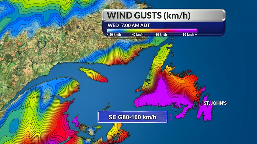
The Avalon and Burin peninsulas will stay on the warmer side of the system, Day said, adding parts of Newfoundland can expect winds gusting to 60-80 kilometres per hour.
Rainfall is not going to be especially significant in most parts of the province, with 15-25 millimetres expected on the Avalon Wednesday before tapering off and giving way to sunshine on Thursday.
“The west coast will see a little more rain than that, but not terribly so,” Day said.
The west coast will see the wind direction flip around to the northwest with gusts that will eventually weaken.
The Channel-Port-aux-Basques region will see significant storm surge as well, with 10 to 12 metres of surge possible from Wednesday morning until mid-afternoon.
“South-facing coastlines will see some very damaging waves, powerful wind and wave action,” Day said.