ST. JOHN'S, N.L. — There is a scene in the comedy movie ‘Naked Gun” where Lieut. Frank Drebin, played by Leslie Nielsen, is shown standing in front of an exploding fireworks factory urging onlooking citizens to move along because “there is a nothing to see here.”
The gag is that there was indeed plenty to see, what with the building engulfed in flames and the sky full of pyrotechnics. If it had been real life and Drebin had been a real police officer, he would have told the gathered crowd to leave the area because lives were in immediate danger.
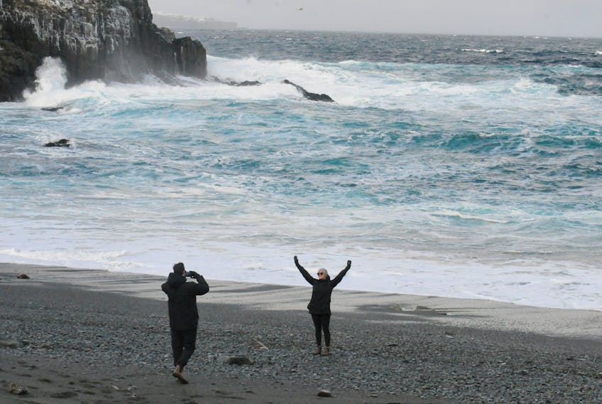
In a way, it’s the reasoning behind the Dept. of Justice and Public Safety’s alert this week encouraging Newfoundland residents — especially those in the eastern part of the province — to be cautious around coastlines over the weekend. That’s because of the expectation of high waves, pounding surf and higher than normal water levels, especially on the east and northeast coast.
Such swells can make for a spectacular sight, but just like a burning building full of fireworks, they can be exceedingly dangerous for those who venture too close.
SaltWire meteorologist Cindy Day said wave heights on the eastern shore of the Avalon could reach four metres or more between 8 and 9 a.m. Saturday morning, the hour of high tides in the area.

To put that in perspective, four metres represents one storey of a normal building.
Those swells will be reach shores hundreds of kilometres away from the storm creating them. In fact, waves near the centre of the storm out in the mid-Atlantic will reach 15 metres or nearly 50 feet.
The storm has led to marine gale warnings being issued for waters off the Avalon and Bonavista Peninsula, as well as Placentia Bay. However, because the associated low-pressure system is so far offshore, there were no weather advisories for the island of Newfoundland.
Nevertheless, the storm’s reach is lengthy. Think of Saturday morning’s waves as the fingertips at the end of an extended arm belonging to an angry giant.
“Even though the storm that’s causing this is well off the coastline, it is powerful,” said Day "We have to thank our lucky stars it didn’t come a little closer to the coast because that would have been a full-on winter hurricane, if you will.”

Swells are created by the increasing frequency of waves.
“In this case, the swells just continue to build because — between the coastline and the centre of that low hundreds of kilometres away — there is nothing to stop that big collection of waves from rolling and growing as it moves away from this powerful storm,” said Day.
When asked to explain the difference between swells and a storm surge — such as the one that swept away a good part of a breakwater in Conception Bay South this week — Day said they aren’t so much different as related.
“A surge is the crashing of swelling waves close to the coastline or at the water's edge,” she said. “When they crash and break up, that raises the water level.”
As this particular storm moves past Newfoundland, winds coming from east to northeast Friday evening were forecast to intensify to northeasterly overnight, then move around to the northwest by noon Saturday before diminishing.

The change in wind direction means the province’s advisory — which also mentions the possibility of flooding, especially near the time of high tides — also involves parts of southwestern Avalon Peninsula and the eastern side of the Burin Peninsula.
“The change in wind direction is why you see a couple of different-facing coastlines mentioned,” said Day.