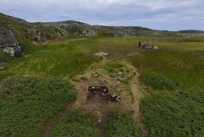
OKAK ISLANDS, N.L. — For more than 300 years, Kivalekh was an Inuit winter village in the Okak Islands, located approximately 100 kilometres north of Nain.
“As at the winter village of Uivakh on the mainland just north of Okak, residents of Kivalekh probably hunted bowhead whales and harp seals in the fall, and ringed seal throughout the winter,” said Peter Whitbridge, a Memorial University (MUN) archaeologist. “Although there is a large number of winter houses (at least 50) at Kivalekh, until we investigate further it is impossible to estimate how many might have been occupied at any one time. Moravians counted about 120 people in six houses there in 1773.”
Further investigation, designed to promote conservation and commemorate the 1918-19 Spanish influenza epidemic that decimated the community, is scheduled for this summer.
Whitbridge, with a team of four assistants, plans to spend the last three weeks of July in the field. They will be working to build on research conducted between 1974 and 1984 that focussed more on pre-Inuit (Dorset) occupation of the area and which, Whitbridge said, produced a map that is not very accurate in light of modern satellite imagery.
The 2018 field work will take advantage of the latest technology.
“This summer we plan to carefully survey the site with a total station (an electronic optical surveying instrument), as well as generating an aerial photo mosaic and 3D model by taking photographs with a drone,” Whitbridge explained. “We will also survey the surrounding area for additional sites, and excavate small tests in midden (historic domestic waste) areas to generate datable organic samples.”
Whitbridge initiated drone mapping in Labrador in 2016 at Johannes Point (Hebron Fiord). He plans to expand the program in line with what is happening generally in the discipline of archaeology.
“I think we can produce an extremely rich body of maps and imagery of northern Labrador sites that will be of great value, not only to other archaeologists, but to Labrador communities, government land managers, other researchers and the tourism industry,” he said.
Whitbridge said they are going back to northern Labrador with a more powerful drone and better quality camera than in 2016.
“I hope we will raise the bar on the kind of aerial document it is possible to produce in a relatively short time,” he said. “There is a wider move in archaeology to replace time-consuming ground survey with high resolution aerial mapping.”
Whitbridge expects this summer’s project will provide a better idea of the potential of the newest drones and drone cameras to dramatically speed up the mapping process —from weeks to days — especially in a wilderness field setting where time on the ground is extremely costly.