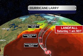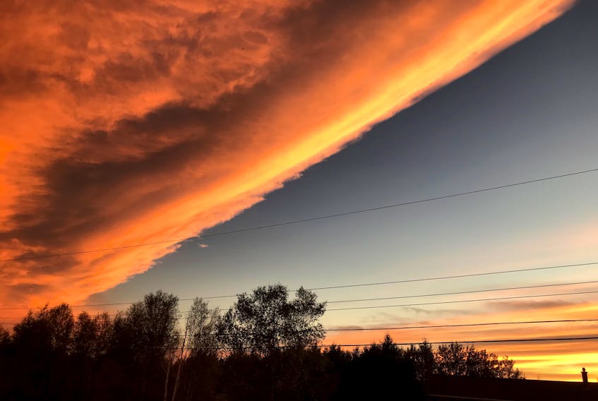
It was quite something, and not many of you missed it! I'm always telling you to look up, and judging by the reaction to an unusual cloud bank, you have been.
This sharp line in the sky was drawn just over two weeks ago, on Friday, Oct. 2. The next day, the photos started to roll in. I can honestly say that I have never seen so many photographs of one cloud formation submitted by so many of you from across the region.


What many of you saw was the backside of a frontal trough that was backing in from the east; that explains why it was observed in the northeastern sky. Weather fronts mark the boundaries of air masses of different properties, which don't easily mix. Behind a cold frontal line, the air is usually drier, the sky is often clear and temperatures are cooler.

- Want more weather information? Visit your weather page.
- Have a weather question, photo or drawing to share with Cindy Day? Email [email protected]
Cindy Day is the chief meteorologist for SaltWire Network