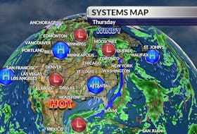
The fast-moving ribbon of air in the upper level of the atmosphere known as the jet stream continues to track well north of our region. It acts as a highway along which systems travel and it divides warm air from cold. I don’t expect a drop in its northern position over Atlantic Canada for at least another week.

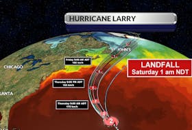
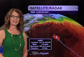
I wouldn’t be surprised to see widespread heat warnings issued for our region for most of next week. As far as the rain goes, I am watching a developing system that should track just off the Atlantic Coast of Nova Scotia late tonight and Saturday, reaching the southeastern regions of Newfoundland on Sunday.
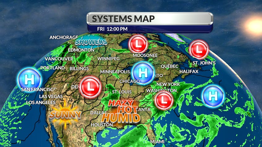
This system will bring rain to Nova Scotia and the Avalon, but it should stay dry across New Brunswick, P.E.I., and the rest of Newfoundland and Labrador. Rainfall totals will likely be in the 10 to 20 mm range. The next line of wet weather will develop on the leading edge of a cold front late next week.

- Want more weather information? Visit your weather page.
- Have a weather question, photo or drawing to share with Cindy Day? Email [email protected]
Cindy Day is the chief meteorologist for SaltWire Network