<img height="1" width="1" style="display:none" src="https://www.facebook.com/tr?id=288482159799297&amp;ev=PageView&amp;noscript=1">

Web Notifications

SaltWire.com would like to send you notifications for breaking news alerts.

Activate notifications?

Saltwire Logo

Welcome to SaltWire

Register today and start
enjoying 30 days of unlimited content.

Get started! Register now

Already a member? Sign in

CINDY DAY: Humberto reached out to Cape Breton

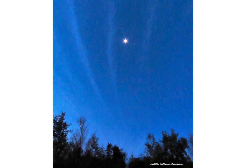
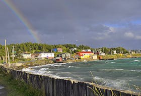
This lovely pattern in the sky greeted Judy LeBlanc-Brennan before the sun came up over Cape Breton NS.  It was a subtle reminder of a powerful storm spiralling hundreds of kilometres offshore.
This lovely pattern in the sky greeted Judy LeBlanc-Brennan before the sun came up over Cape Breton NS. It was a subtle reminder of a powerful storm spiralling hundreds of kilometres offshore. - Contributed

STORY CONTINUES BELOW THESE SALTWIRE VIDEOS

Weather’s role in wildfires in Atlantic Canada | SaltWire #weather #climatechange #wildfireseason

Watch on YouTube: "Weather’s role in wildfires in Atlantic Canada | SaltWire #weather #climatechange #wildfireseason"

Hurricane season is at its peak in the Atlantic Basin. After a slow start, tropical activity is heating up. On Sept. 20, less than one week after Dorian made landfall in Nova Scotia, many watched as Hurricane Humberto headed our way. Humberto was projected to slide south of Sable Island Friday afternoon then track south of the Avalon very early Saturday morning. Thankfully, this storm offered no surprises.

Friday morning, as the powerful cyclone churned hundreds of kilometres offshore, Judy LeBlanc-Brennan spotted something quite interesting in the pre-dawn sky and posted this on my Facebook page: 

“…When I stepped out to go for a walk this morning around six and it was still a little dark I could not believe the sky!! There were stripes of clouds across the sky. I even had to get my husband out to look at it. I took a picture but my camera does not take good pictures in the dark. I hope someone else noticed the sky this morning.”

Judy that was Humberto. Despite how things appear on weather maps, a hurricane is more than a point and its path is more than a line. It is a large system that spreads out over a very wide area. The main parts of a hurricane are the cloud and rain bands on its outer edges, the eye, and the eyewall. Air spirals in toward the centre in a counter-clockwise pattern, and out the top in the opposite direction. In the very centre of the storm, air sinks, forming the cloud-free eye. The storm’s outer cloud bands can extend several hundred kilometres from the eye. 

These bands form the outer-most fringes of the tropical cyclone structure. They can be 500 km long and very impressive to watch as they slowly spiral overhead.  

I’m so glad Judy noticed these far-reaching spokes as they brushed by Cape Breton before the sun came up Friday morning. 

Satellite imagery showing cloud bands – like spokes on a wheel -extending outward from Hurricane Humberto.

It has been our privilege to have the trust and support of our East Coast communities for the last 200 years. Our SaltWire team is always watching out for the place we call home. Our 100 journalists strive to inform and improve our East Coast communities by delivering impartial, high-impact, local journalism that provokes thought and action. Please consider joining us in this mission by becoming a member of the SaltWire Network and helping to make our communities better.
Share story:
ADVERTISEMENT
ADVERTISEMENT
ADVERTISEMENT

Local, trusted news matters now more than ever.
And so does your support.

Ensure local journalism stays in your community by purchasing a membership today.

The news and opinions you’ll love starting as low as $1.

Start your Membership Now