I don't think you have to be a meteorologist to be enthralled by the wild weather in Texas and across the southeastern United States. Record snowfall, record cold and powerful winds battered the region most of the week.
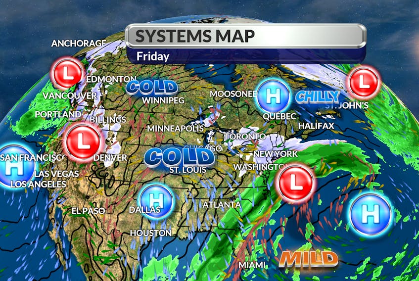
A very sharp dip in the jet stream allowed arctic air to plunge southward. That same jet stream sits just offshore and will steer a developing Nor'easter our way. A ridge from the pocket of cold air is pushing down on the incoming storm; that's good news if you're not a fan of snow. Without that blocking pattern, the Nor'easter would come closer to our coastline with significant snow and wind.

It’s important to point out that a slight shift in the forecast track of the offshore storm will impact our snowfall totals: closer to the coast – more snow; farther offshore - less snow. By Sunday morning, the low-pressure system will be east of the Avalon and the cold air that guided the storm will come rushing down behind it.
If you plan on playing in the new snow, you’ll need your best winter gear: wind chill values will range from -10 to -16 through the middle part of the day.

- Want more weather information? Visit your weather page.
- Have a weather question, photo or drawing to share with Cindy Day? Email [email protected]
Cindy Day is the chief meteorologist for SaltWire Network