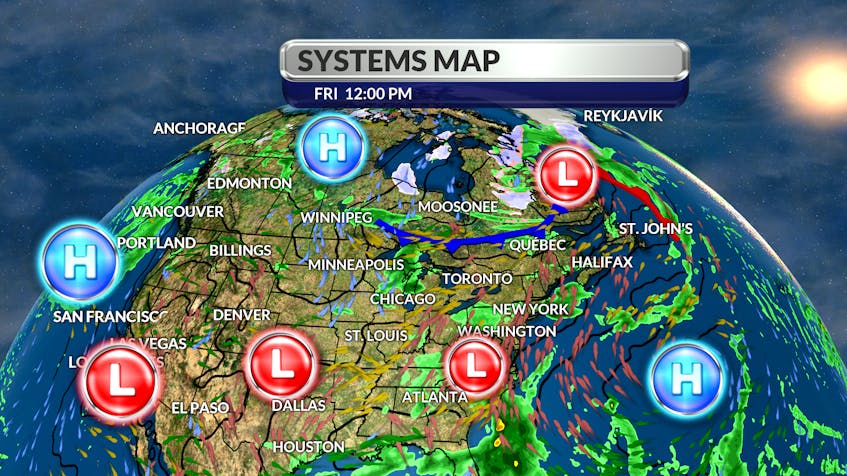
It came up over Newfoundland last weekend, rolled back to northern Quebec during the week and is now spinning over Labrador.
That’s an unusual path for such a large area of low pressure. That occurrence is referred to as a system in retrograde, meaning going against the normal flow. The weather system that brought rain and even some snow to Western Labrador was being held back by a large area of high pressure south of Greenland.

Now that the offshore high is sinking southward, the pesky system will, once again, cross the region – this time from west to east. As it does so, it will pull a frontal boundary through on Saturday and Sunday. We can expect anywhere from 10 to 15 mm of rain on the leading edge of the front; there’s also a chance of thundershowers.
The line of weather is expected to stall over eastern Newfoundland Sunday to Monday and rainfall totals could be between 50 to 70 mm. A strong Hudson Bay High will snuggle in behind the wet weather - clearing skies will come with a cool north wind and a significant drop in temperature.

- Want more weather information? Visit your weather page.
- Have a weather question, photo or drawing to share with Cindy Day? Email [email protected]
Cindy Day is the chief meteorologist for SaltWire Network