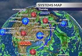
It’s been quite a week. Tuesday’s record high temperatures were followed by snow and bitter wind chill; it felt 25 degrees colder by Thursday morning.
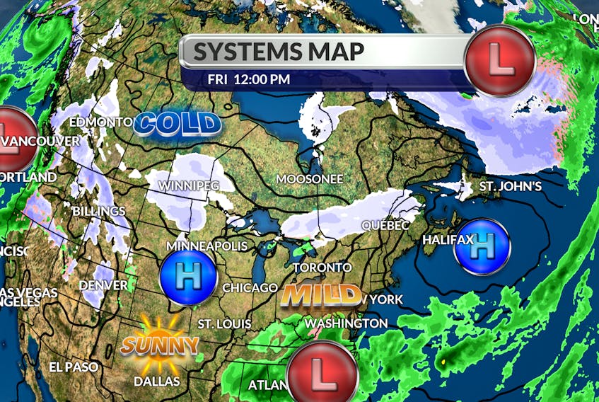
We’re in a lull between systems right now, but we won’t be for much longer. Another powerful late fall storm will track up the Ohio Valley and join forces with a developing offshore low.
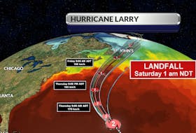
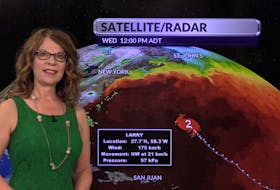
The new and more powerful weather system will cross the Gulf of Maine, and track through northern New Brunswick before finally reaching Labrador on Sunday.
Warm air on the south side of the low will flood the region tonight and Saturday and linger through much of Sunday.

Rainfall totals will be highest along the Atlantic coastlines with as much as 60 mm in a fairly short period of time; watch for localized flooding where the waterfalls on frozen ground.
The wind is going to be a factor ahead of, and behind the soggy system.
Southeasterly winds will gust to 70 km/h with the rain, before turning to the west behind the moisture.
Monday will be drier but very windy with peak gusts approaching 80 km/h.

- Want more weather information? Visit your weather page.
- Have a weather question, photo or drawing to share with Cindy Day? Email [email protected]
Cindy Day is the chief meteorologist for SaltWire Network