It’s not easy to write this without saying, “When I was young…”
Years ago, winter was winter. It got cold and, for the most part, stayed cold until spring arrived.
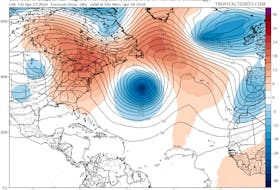
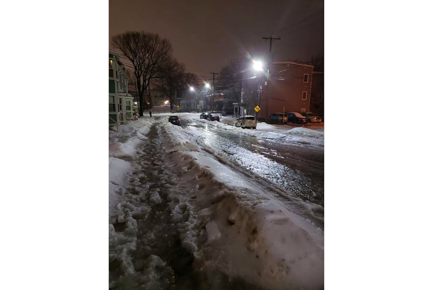
Since the 1990s, the weather patterns have shifted: winter comes later and so does spring. During our recent winters, we’ve been spending as much time in our raincoats as in our parkas. Temperatures don’t settle for very long and we’re left with wild temperature fluctuations with each passing system. Sometimes the change is fairly gradual, as was the case Jan. 25, but it can also be quite abrupt, especially going from mild back to cold. When the arctic pipeline opens up, temperatures can drop in a flash – in fact, that is known as a “flash-freeze.”
In Canada, flash-freeze warnings are issued when a rapid drop in air temperature is expected. Officially there’s no “rate-of-fall” criteria attached to the definition, but the drop must be significant over a fairly short period of time. Also, the temperature must fall from above freezing to well below 0 C, freezing water already on the ground.
A powerful, arctic cold front that has been working its way eastward is set to blast across our region. We’re going to go from wet to frozen quite quickly. Keep an eye on the temperature and adjust your travel plans accordingly.
- Read more Weather University columns.
- Have a weather question, photo or drawing to share with Cindy Day? Email [email protected]
Cindy Day is the chief meteorologist for SaltWire Network.
RELATED