Many of you have been asking what happened on Saturday in Nova Scotia.
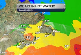
The day got off to a very warm start – mid-twenties by midmorning. By early afternoon, temperatures had settled in the thirties and that’s when a back-door cold front crossed the region.
Temperatures were tumbling from east to west – not the usual west to east change of air mass with a cold front. As the front came through, the wind shifted from the north to the east and temperatures dropped, nowhere more quickly than in Halifax, where the new air mass was one thing, but the east-southeast wind off the water added insult to injury. At 6 p.m., it was 27 degrees at the Halifax airport; by 9:30 p.m. it had dropped to 13!
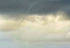
That frontal line triggered some convective weather and a severe thunderstorm warning was issued for Lunenburg County at 6:27 p.m. ADT, just minutes before the official arrival of summer. Not long after that, photos started to roll in of a Mammatus cloud hanging low in the sky in the wake of the isolated thunderstorms.
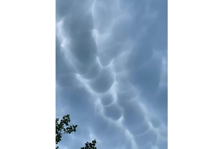
These impressive clouds are known as mammatocumulus. The name ‘Mammatus’ is derived from the word ‘mamma’, which, in Latin, means breast or udder. As you can see in the photo, they’re clouds that drift in with pouches at the bottom.
These clouds are commonly associated with violent thunderstorms and tornadoes but not always! Mammatus clouds result from the sinking of moist air into dry air.
For Mammatus to form, the sinking air must be cooler than the air around it and have high liquid water or ice content. Mammatus clouds are long-lived if the sinking air contains large drops; the larger particles require greater amounts of energy for evaporation to occur. Over time, the cloud droplets do eventually evaporate and the Mammatus clouds dissolve. So, if you think about it, Mammatus clouds are upside-down clouds.
Even though Mammatus clouds themselves are harmless, they are often harbingers of a dangerous storm nearby, so if you see them in the sky, take caution.
- Want more weather information? Visit your weather page.
- Have a weather question, photo or drawing to share with Cindy Day? Email [email protected]
Cindy Day is the chief meteorologist for SaltWire Network